Beach Management Restoration Projects
Details about various Shore Protection Projects along the Brevard County.
Port Canaveral Sand Bypass Project
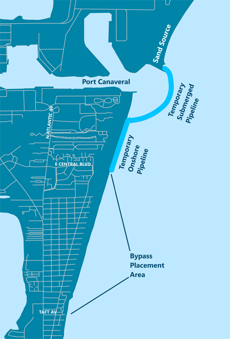
The Port Canaveral Sand Bypass Project began in 1995 after the Port’s north Jetty was lengthened and tightened to trap sand and prevent it from flowing into the navigation channel. This interruption of the natural southerly sand flow is estimated to cause sand losses of approximately 156,000 cy/yr on the beaches south of the inlet. To offset the losses and maintain a healthy shoreline, approximately 3.5 million cubic yards of sand have been dredged from beaches north of the Port Canaveral harbor inlet and bypassed south across the inlet to beaches along the Cape Canaveral shoreline.
In 2010, the U.S. Army Corps of Engineers completed the fourth and most recent implementation of the federal Sand Bypass Project with the Canaveral Port Authority as the local sponsor. Prior bypassing efforts occurred in 1995, 1998, and 2007.
Brevard County Shore Protection Project
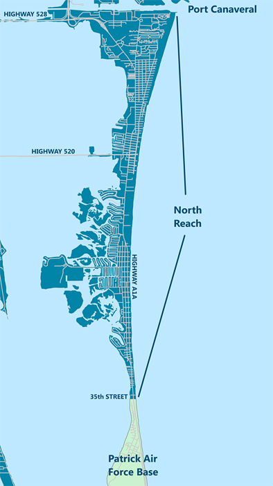
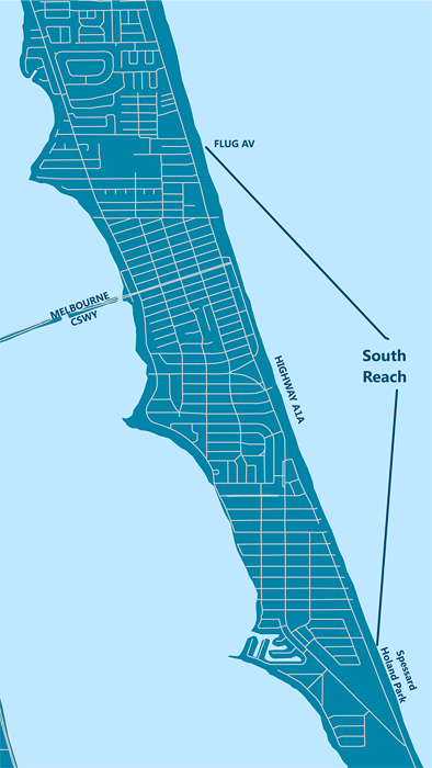
The Brevard County Shore Protection Project is comprised of two Reaches, the North Reach and the South Reach. The North Reach stretches 9.4 miles from Jetty Park in Cape Canaveral south to the northern limit of Patrick Air Force Base. The South Reach stretches 3.8 miles from Flug Avenue in Indialantic south to Spessard Holland Park in Melbourne Beach. The federal project is implemented by the U.S. Army Corps of Engineers with Brevard County as the local sponsor.
North Reach (Brevard County Shore Protection Project)
2014 Recovery Project
To counter erosion caused by Hurricane Sandy during the 2012 hurricane season, the US Army Corps of Engineers awarded a contract to Great Lakes Dredge & Dock Company (GLDD) to renourish 7 miles of the North Reach.
Sand placement began on January 28, 2014 and all beach work was completed prior to the start of main sea turtle nesting season on May 1st. GLDD placed 972,410 cubic yards of sand along the North Reach shoreline between Cheri Down Park in Cape Canaveral and Surf Road in Cocoa Beach and between 3rd Street North in Cocoa Beach and the northern limit of Patrick AFB. The sand was dredged from Canaveral Shoals, an offshore borrow area located approximately 6 miles east of Cape Canaveral.
The remainder of the North Reach shoreline between Surf Road and 3rd Street North has remained stable and did not receive sand. Construction funding for the project was 100% federal.
2005 Recovery Project
To counter erosion caused during the 2004 hurricane season, the U.S. Army Corps of Engineers awarded Weeks Marine, Inc. a contract to renourish 5.95 miles of the Brevard County Shore Protection Project’s North Reach.
In 2005, using two hopper dredges, Weeks placed approximately 755,500 cubic yards of sand on two areas of shoreline; first in the area of Cocoa Beach between North 3rd Street and Patrick AFB, and then in the area between Cherie Down Park in Cape Canaveral and Gadsden Lane in Cocoa Beach.
The remaining areas of the North Reach did not lose enough sand to qualify for renourishment and in fact, gained sand during the storms from overwash.
North Reach History
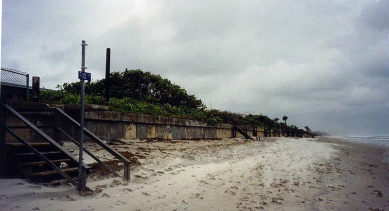
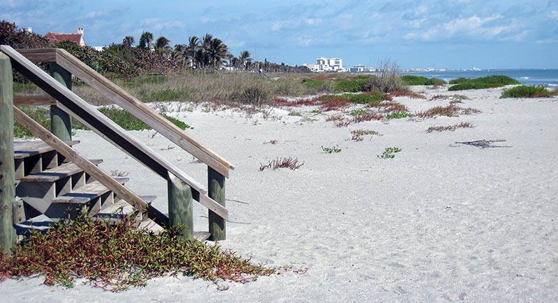
The Brevard County Shore Protection Project finally became a reality for Space Coast residents on August 28, 2000, when the U.S. Army Corps of Engineers awarded initial restoration of the North Reach (encompassing Cape Canaveral and Cocoa Beach) to Great Lakes Dredge and Dock Company. Using innovative construction methodology suggested by Brevard County, this phase in the restoration of the North Reach was completed one year ahead of schedule at a cost savings exceeding $700,000.00 In just one season, the entire 9.4 mile North Reach was renourished placing 2.8 million cubic yards of sand on the beaches of Cape Canaveral and Cocoa Beach.
On October 1, 2000, the first hopper dredge, the Padre Island, arrived and began moving sand from the Canaveral Shoals offshore borrow area into the North Reach nearshore re-handling area located 4,000 ft. offshore Cocoa Beach, across from the Minutemen Causeway.
A second hopper dredge, the Manhattan Island, joined the operation on October 8, 2000. Despite rough seas, both dredges continued to move sand around the clock. A third dredge, the Dodge Island, joined operations later in the project.
To protect sea turtle hatchlings, no sand was placed on the beach until the end of the 2000 turtle nesting season. In mid-November 2000, the Alaska-a cutterhead dredge-arrived and, aided by a booster pump, began pumping sand onto the shore via a pipeline running from the North Reach nearshore re-handling area. Initial construction of the entire 9.4 mile North Reach of the Brevard County Shore Protection Project was completed on April 9, 2001, a truly amazing feat!
Patrick Air Force Base
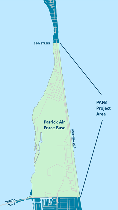
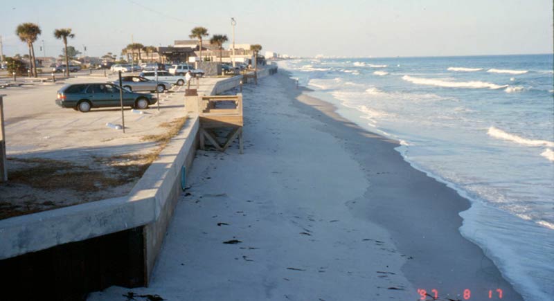
Since 1998, four beach restoration projects implemented and managed by the U.S. Air Force have taken place along four miles of Patrick Air Force Base (PAFB) shoreline immediately south of Cocoa Beach.
The first, a truck haul project in 1998, placed 165,000 cubic yards of sand on the beach from an upland disposal area. A subsequent hydraulic beach fill from an offshore sand source in 2000-01 placed 560,000 cubic yards of sand and a post-hurricane beach and dune renourishment placed another 300,000 cubic yards of sand in 2005. Both hydraulic projects required construction coordination with Brevard County and utilized an innovative design to successfully avoid impacts to nearshore rock outcrops.
A combination of sand fencing and native dune planting (using predominantly sea oats) also contributed to the shoreline stabilization. In 2011, a small truck-haul moved 60,000 cubic yards of sand from Cape Canaveral Air Force Station beaches north of the Port Canaveral Harbor south to reinforce the PAFB shoreline.
.jpg?sfvrsn=29a09656_6)
Mid Reach
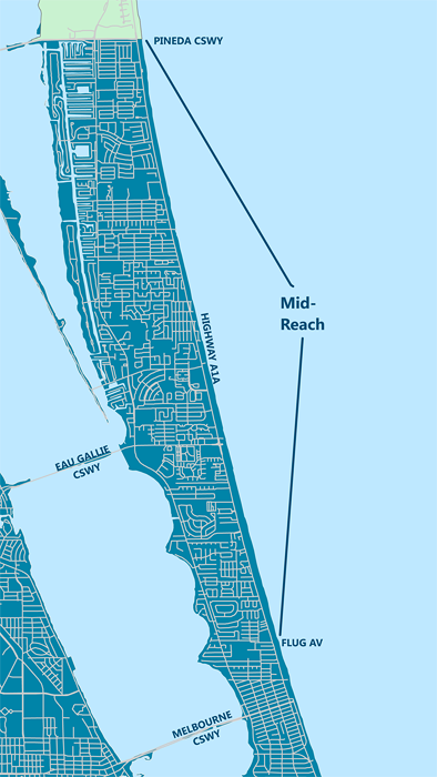
On August 31, 2016, a Project Partnership Agreement was signed by the U.S. Army Corps of Engineers and Brevard County. The Agreement allowed the Mid Reach (the 7.6 miles immediately south of Patrick Air Force Base and extending to Flug Avenue in Indialantic) to formally become part of the Brevard County Shore Protection Project, as authorized by Congress. Prior to that date, the Mid Reach was excluded from the Project due to the presence of rocky outcrops along the shoreline. These rocky outcrops are composed of compressed coquina shell sediments.
The term "worm rock" has been used loosely, and sometimes inappropriately, to describe the coquina rock outcrops. While these areas do provide habitat for a tube-forming polychaete worms, these rocks also offer shelter, food, and breeding areas for a variety of species, including fish, marine turtles, and attached plants and animals. Those habitat values are recognized by the National Marine Fisheries Service, which designates such rocks as “Essential Fish Habitat.” Over geologic time, the coquina rock outcrops have withstood variations in sea level that have caused them to be alternately buried and exposed.
The County has been working with state and federal agencies for more than a decade to develop an acceptable proposal for shore protection along the rocky area. The County has obtained both State and Federal permits which authorize limited sand placement while minimizing burial of rock habitat. Burial of up to 3 acres of rock, which is less than 10% of rock in the area, is approved in the permits. This rock impact will be mitigated by the construction of an artificial reef immediately offshore. Ten reef sites have been selected and the placement of low lying, concrete mats topped with coquina limestone in approximately fifteen feet of water will begin in May 2017. The reef sites will be roughly 1,000 feet from the beach and will form approximately 4.8 acres to mitigate up to 3 acres of nearshore coquina rock. Federal and state agencies tasked with environmental permitting review for beach projects require that impacts to environmental resources be both minimized and mitigated, and the County's proposal meets this goal. The relevant agencies include the U.S. Fish & Wildlife Service, the U.S. Environmental Protection Agency, the U.S. Army Corps of Engineers, the National Oceanic & Atmospheric Administration's National Marine Fisheries Service, the Florida Department of Environmental Protection, and the Florida Fish & Wildlife Conservation Commission.
The U.S. Army Corps of Engineers completed an approved General Re-evaluation Report (GRR) for the Mid Reach that compares the economic benefits of beach restoration, dune restoration, and coastal armoring along the Mid Reach shoreline. The GRR also includes a Supplemental Environmental Impact Statement that evaluates the impacts of shore protection alternatives on the rock outcrops in the Mid Reach surf zone, and potential measures that can be taken to minimize and mitigate such impacts. The GRR recommends a plan very similar to that approved in the County's permit.
The U.S. Army Corps of Engineers are currently developing plans and specifications for sand placement along the Mid Reach and the County is seeking federal construction funds to match available state and local funds. Brevard County's Local Option Tourist Tax provides a dependable source of local match for Mid Reach construction, mitigation, and monitoring.
2014 Recovery Project
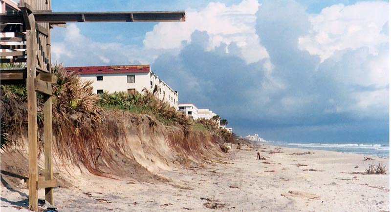
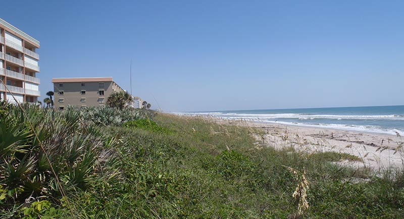
In response to erosion caused by Hurricane Sandy, the Board of County Commissioners approved funding for a full scale dune restoration project in the 7.8 mile Mid Reach between Patrick AFB and Flug Avenue in Indialantic. The contract was awarded to J.P. Donovan Construction who placed 195,863 cubic yards of sand on Mid Reach beaches between December, 2013 and March, 2014.
Mid Reach History
In response to the storm damage in 2004, an emergency engineered berm project was constructed along the Mid Reach in early 2005. The project, funded by FDEP, FEMA, and Brevard County, placed 307,300 cubic yards of sand along the Mid Reach to stabilize and protect the dune bluff and upland properties. The engineered berm project was maintained as needed in 2006, 2008, and 2009 to repair damage after storm events. A detailed report which summarizes the construction and maintenance of the engineered dune project both in the Mid Reach and in the South Beaches can be requested. Documents are listed below.
Mid Reach Status
The County has been working with state and federal agencies to develop an acceptable proposal for shore protection along the rocky area. The County has obtained both State and Federal permits which authorize limited sand placement while minimizing burial of rock habitat. Burial of up to 3 acres of rock, less than 10% of rock in the area, is approved in the permits. This rock impact will be mitigated by the construction of an artificial reef immediately offshore. Federal and state agencies tasked with environmental permitting review for beach projects require that planned damage to environmental resources be both minimized and mitigated, and the County's proposal meets this goal. The relevant review agencies include the U. S. Fish and Wildlife Service, U. S. Environmental Protection Agency, U. S. Army Corps of Engineers, the National Oceanic and Atmospheric Administration’s National Marine Fisheries Service, the Florida Department of Environmental Protection and the Florida Fish and Wildlife Conservation Commission.
The U.S. Army Corps of Engineers completed a General Re-evaluation Report (GRR) for the Mid Reach in 2012. The GRR compares the economic benefits of beach restoration, dune restoration and coastal armoring along the Mid Reach shoreline. The GRR also includes a Supplemental Environmental Impact Statement that evaluates the impacts of shore protection alternatives on the rock outcrops in the Mid Reach surf zone, and potential measures that can be taken to minimize and mitigate such impacts. The GRR recommends a plan very similar to that approved in the County's permit.
The GRR has now received final approval and the U.S. Army Corps of Engineers are now in the process of developing plans and specifications for project construction. The County has begun to pursue construction funds on local, state, and federal levels. Brevard County's passage of the 5th one-cent addition to the Local Option Tourist Tax and subsequent re-allocation of exiting collections should provide a dependable source of local match for Mid Reach construction, mitigation, and monitoring.
What can you do?
Construction of the Mid Reach is subject to federal appropriations. Write or email your legislators today and let them know you support state and federal funding for beach restoration projects.
South Reach (Brevard County Shore Protection Project)
2014 Recovery Project
To counter erosion caused by Hurricane Sandy during the 2012 hurricane season, the US Army Corps of Engineers awarded a contract to Great Lakes Dredge and Dock Company (GLDD) to renourish the 3.8 mile South Reach. Sand placement began on November 27, 2013 and all beach work was completed by February 24, 2014. Approximately 692,418 cubic yards of sand were placed along the shoreline between Flug Avenue in Indialantic and Spessard Holland Park in Melbourne Beach. The sand was dredged from Canaveral Shoals, an offshore borrow area located approximately twenty miles northeast of the project area. Construction funding for the project was 100% federal.
2010 Scheduled Renourishment
In 2010, Great Lakes Dredge and Dock Company, under contract to the US Army Corps of Engineers, dredged approximately 636,000 cubic yards of sand from the Canaveral Shoals borrow area and placed it on the beaches in the South Reach. The sand quality was excellent and the project was completed on time.
2009-10 South Reach Funding
Federal (56.3%): $7.0 million
State (20.8%):$2.6 million
County (22.9%): $2.8 million*
Total $12.4 million
* Collected from local hotels as a Local Option Tourist Development Tax
2005 Recovery Project
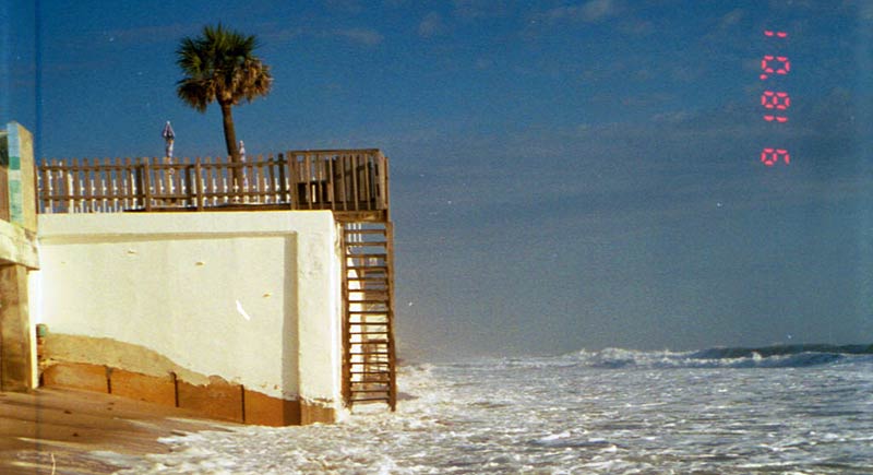
In 2004, Brevard County was battered by Hurricanes Charlie, Frances, and Jeanne. During this catastrophic hurricane season, the South Reach Shore Protection Project successfully protected all oceanfront structures in the project area from direct ocean impacts. In early 2005, the US Army Corps of Engineers contracted Weeks Marine, Inc. to construct an emergency sand placement project to mitigate the sand losses caused by erosion during the storm events. Bean Stuyvesant, LLC, a sub-contractor of Weeks Marine, Inc. used the largest hopper dredge operating in United States waters at the time to move approximately 578,900 cubic yards of sand 20 miles from the Canaveral Shoals borrow area to the 3.8 mile shoreline of the South Reach.
South Reach History
On October 31, 2001 as part of the 2001-2002 Energy and Water appropriations bill Congress authorized $6 million to begin renourishment of the South Reach, encompassing Indialantic and Melbourne Beach. Although the events of September 11th delayed the federal authorization, the U.S. Army Corps of Engineers sliced through “red tape” and were able to award a construction contract in record time. Great Lakes Dredge and Dock Company was awarded the South Reach construction contract on December 20, 2001. This was welcome news for residents of Melbourne Beach, especially those who had experienced severe beach erosion and were on the verge of losing their homes.
On January 13, 2002 the Padre Island hopper dredge began moving sand from the Space Coast Shoals offshore borrow area into the South Reach nearshore disposal and sand re-handling area located approximately 1/2 mile offshore of Tampa Avenue in Indialantic. On March 12th, the cutterhead dredge Alaska anchored over the South Reach re-handling area and began pumping sand from the re-handling area through a pipeline onto the beaches between Spessard Holland Park and Tampa Avenue. Even with such a late start, Great Lakes Dredge & Dock Company managed to pump 1.25 million cubic yards of sand onto 3 miles of shoreline during the 2002 construction season, however approximately one mile of beach north of Nance Park could not be completed before, the May 1st commencement of turtle nesting season.
On March 28, 2003, Great Lakes returned with the hopper dredge Liberty Island which used a direct hopper pump-out method to deposit sand onto the beaches from Nance Park north to the Pizza Hut. The South Reach was completed on April 30, 2003.
To nourish the South Reach, approximately 1.574 million cubic yards of sand were placed on the beach. Space Coast Shoals provided 1.2 million cubic yards of sand and the remaining 374,000 cubic yards came from Canaveral Shoals. Canaveral Shoals was also the sand source for the entire North Reach and is anticipated to meet all of Brevard County’s future beach replenishment needs.
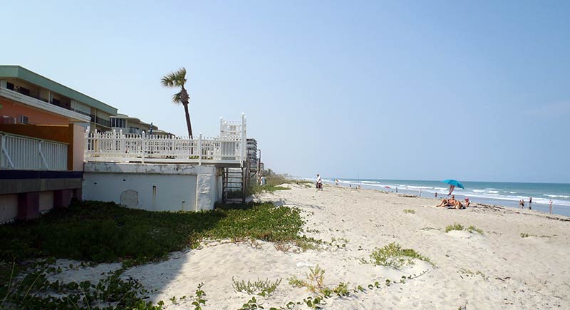
Indialantic Beach - Before South Reach Nourishment (1999) and after South Reach Nourishment (2012)
South Beaches
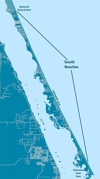
The term “South Beaches” describes the 14.5 mile length of shoreline extending south from Spessard Holland Park (the southern terminus of the Brevard County Federal Shore Protection Project South Reach) to Sebastian Inlet State Park. The South Beaches were severely eroded by hurricanes Charlie, Frances and Jeanne in 2004, and the Florida Department of Environmental Protection (FDEP) classifies the 11.6 miles of South Beaches shoreline north of Bonsteel Park as critically eroded.
2014 Recovery Project
In response to erosion caused by Hurricane Sandy, the Board of County Commissioners approved funding for a reduced scale dune restoration project only in the most severely eroded areas. The contract was awarded to J.P. Donovan Construction who placed 47,248 cubic yards of sand in the South Beaches between February and April, 2014.
South Beaches History
In response to the storm damage in 2004, an emergency engineered berm project was constructed along the South Beaches in early 2005. The project, funded by FDEP, FEMA, and Brevard County, placed 252,200 cubic yard of sand along 76% of the South Beaches to stabilize and protect the dune bluff and properties. The project prioritized protection of developed property and excepted the larger expanses of undeveloped land that comprise roughly 24% of the shoreline. These “gaps” are primarily government owned land in the Archie Carr National Wildlife Refuge.
The engineered berm project was maintained as needed in 2006, 2008 and 2009 to repair damage after storm events. A detailed report which summarizes the construction and maintenance of the engineered dune project, both in the South Beaches and the Mid Reach, is available. Documents to be downloaded are listed under Mid Reach.
Other Actions
On May 8, 2007, the BOCC approved a grant from FDEP to fund a reconnaissance level feasibility study to consider various long term shore protection alternatives for the South Beaches and the approximate benefits and costs associated with each. Olsen Associates completed this study in 2007.
Just after the Olsen feasibility study was completed, Tropical Storm/Hurricane Noel impacted Brevard in November 2007. This event caused severe coastal erosion and significant public interest in finding a long term solution.
A community forum followed shortly thereafter, and on December 13, 2007 the Brevard County Board of County Commissioners (BOCC) held a workshop to address coastal erosion and management strategies for the South Beaches. At this December 2007 workshop, the BOCC requested that the County attorney compile the legal details of shore protection funding mechanisms, particularly tax cap implications. Based on the information provided by the County Attorney, a Municipal Services Benefit Unit (MSBU) appeared to be the most readily available funding mechanism that does not have tax cap implications.
In response to critical erosion and citizen requests, the Board of County Commissioners authorized a study on November 17, 2008 to determine how the benefits and proportional costs of shore protection in the South Beaches might be distributed among property owners using a MSBU. This study considered six shore protection alternatives including dune maintenance, an innovative submerged bar project and full scale beach nourishment, plus a seventh alternative for strategic acquisition. No preferred course of action has been determined at this time.